|
Please go to the above icons for more information: "Location"; "House"; "River" "Land"
Rock Stop Farm Rappahannock Academy, Virginia
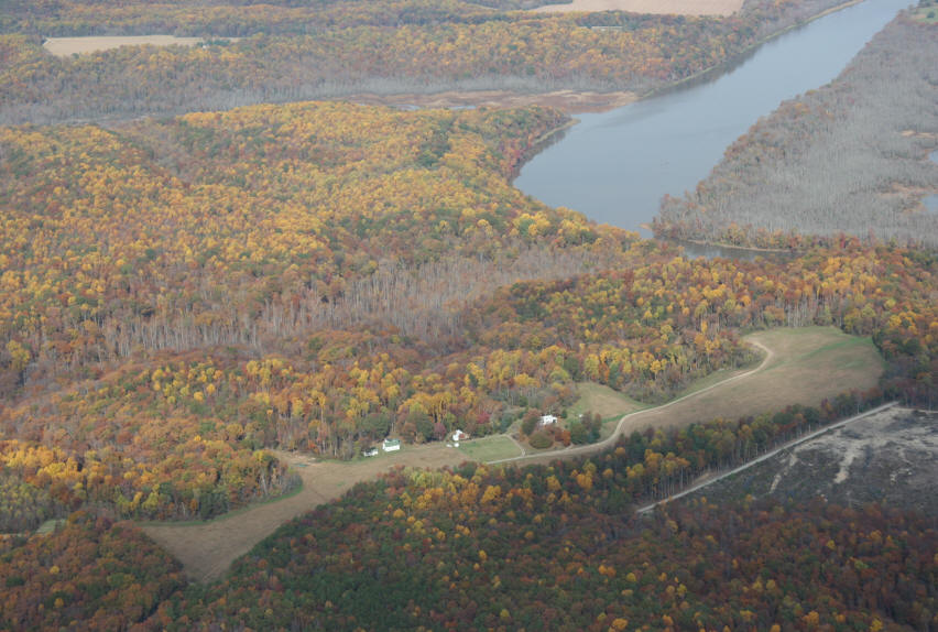
120 Acres : About 1,300 feet on the River featuring both low and high bank river frontage, and a uniquely spectacular house site with panoramic views overlooking the river and river valley. Details at the icon "River Bluff", above.
Please double click to view
Why Rock Stop Farm An idyllic 18th century farm: Fields, Wonderful Hardwood Forest, Stream Valley, and River Frontage. Enjoy; Invest; Create A Legacy Boat, Hunt; Fish, Nature Walks, Cruise the River: Create Memories
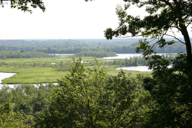
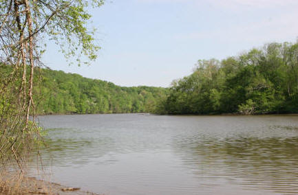
Frontage on the Rappahannock River Cruise the Rappahannock River, a magical river valley of history and beauty; on the river pass picturesque farms, soaring bluffs, stately historic homes, and marshes with waterfowl and majestic eagles.
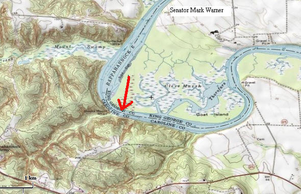
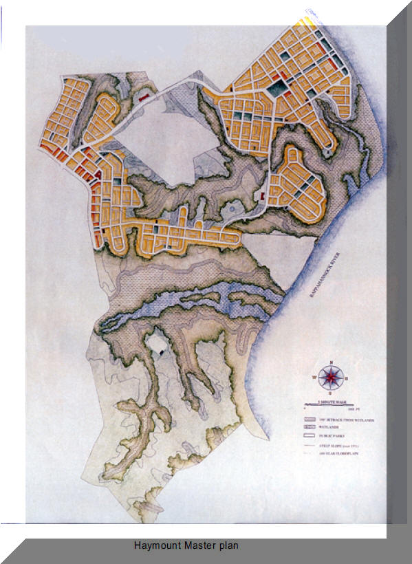
Above, the "Big Picture" Rock Stop is at an elevated plateau, dominating a bend in the Rappahannock River. The plateau is dissected from another plateau across an unnamed creek, which forms a very unique stream valley. Elevation changes are both gentle and abrupt, making the landscape fascinating in terms of aesthetics and the ability to surprise and inspire: This is a property for the person with an affinity for nature and contemplation and/or just plain hunting and fishing. Across the river is Cleve Marsh, a huge wetland, which cannot be built upon. Further up river, Senator Mark Warner owns a farm/vineyard. The Caroline County portion of the valley is designated a "Resource Sensitive Area" and zoned one house per 25 acres (except family subdivisions at two plus acres). Across the creek, which is on Rock Stop, is the boundary for Haymount, a planned community; but the "Open Space" component is between Rock Stop and "Mount Swamp Creek", and has been formally and legally proffered as open space. Any questions can be directed to the Caroline County office of Planning and Community Development (804.633.4303).
Conservation Easements might generate federal tax deductions and state tax credits; Restoration of the house might generate state tax credits if used as a personal residence. OR, if used for income purposes, money spent on Restoration of the house , possible federal and state tax credits. Please call for a broad view of the issues and contact competent legal or tax advise for details. Estate planning benefits might be realized as well, subject to legal and tax advise.
Backs up to Haymont open space of about 600 acres.
The open space component of Haymont is across Mount Swamp Creek, shown in blue on the above map.
Rural -
Private - but near the City It should be noted that the proposed neo-traditional town of Haymont is across the creek and has proffered about 800 acres next to Rock Stop as open space. Thus, with the other lands the backyard or open space is very large. Also, please go to the icon "Location" for more details about the neighborhood. CAROLINE COUNTY WEB SITE AND INFORMATION: http://www.co.caroline.va.us/
HISTORY
Source: Author unknown, 1957. Caroline Historical Guide.
RIVER ACCESS Rock Stop has frontage directly on the Rappahannock River. Please go to the icon "River", at the top of this page for details. The Rappahannock is a tidal body of water leading to the Chesapeake Bay and thence the Atlantic Ocean. Sailing ships once visited the wharfs along the river in colonial times, connecting the populations with Europe. Later, the steamships became the favored means of transportation to the hub at Baltimore, Maryland.
|