![]()
Please be sure to use the icons (above):
"Development"; "River" ; "Plats"; "Zoning"
Fall Hill
Approximately 21 acres
Within the corporate limits of the City of Fredericksburg, Virginia
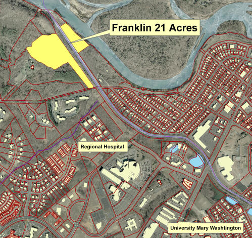
Less than five minutes from: University of Mary Washington; Regional Hospital; Regional Library; Historic Downtown; VRE Commuter Rail Service
OTHER THAN BY CAR: Fall Hill is next to the "Canal Path", a well designed and maintained paved trail along the canal with direct linkages to: Regional Hospital, Route 1 shopping area; University of Mary Washington, and the Historic District and Downtown Fredericksburg.
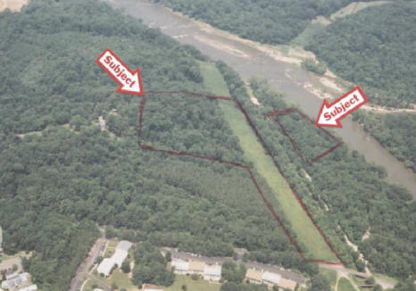
Context: Fall Hill (21 Acres) is bounded by an historic eighteenth century estate with Revolutionary War and Civil War history, which is under easement; several tracts under conservation easement; and the Rappahannock River and City Canal. The large Regional hospital center at Mary Washington Hospital and the University are also immediate dominant features. Downtown historic district is to the east and a huge power center and hotels, etc. to the west.
Will sell, subject to obtaining subdivision plat approval:
| 16.6 acres next to new road to link to hospital, fronting river and canal trials, and fronting on historic canal for $550,000 |
| 4.2 acres with direct frontage on the Rappahannock River for $650,000 |
| Entire Tract for $1,200,000 |
terms are cash.
The property is taxed in the land use category. The Seller will pay no roll-back taxes.
Shown by appointment only, with the listing agent, Alex Long.
Information contained herein is not guaranteed in terms of accuracy and or scope.
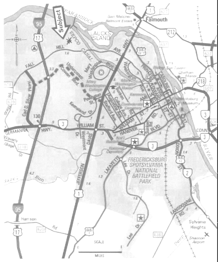
Location:
Double Click
GIS Maps
Below, double click to enlarge, print, or save
NOTE: All maps and data are approximations and not guaranteed in terms of accuracy and/or scope.
Aerial; Context, macro (2006)
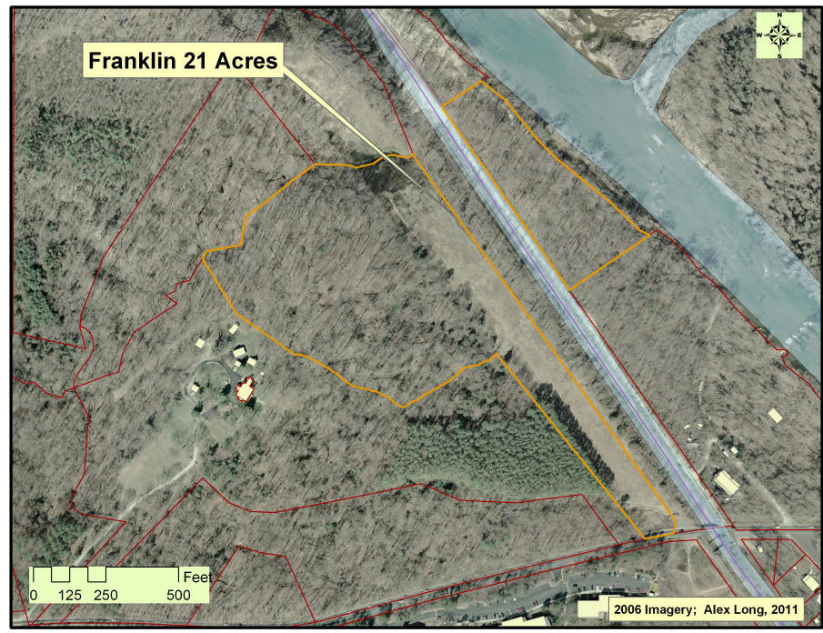 Aerial; Detail; (2006)
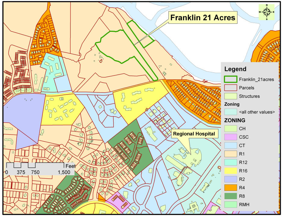
Zoning; R16 (16 du per acre) is across the street.
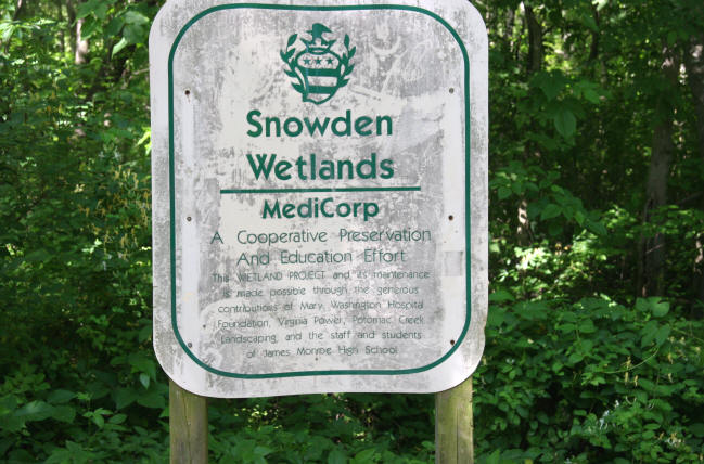
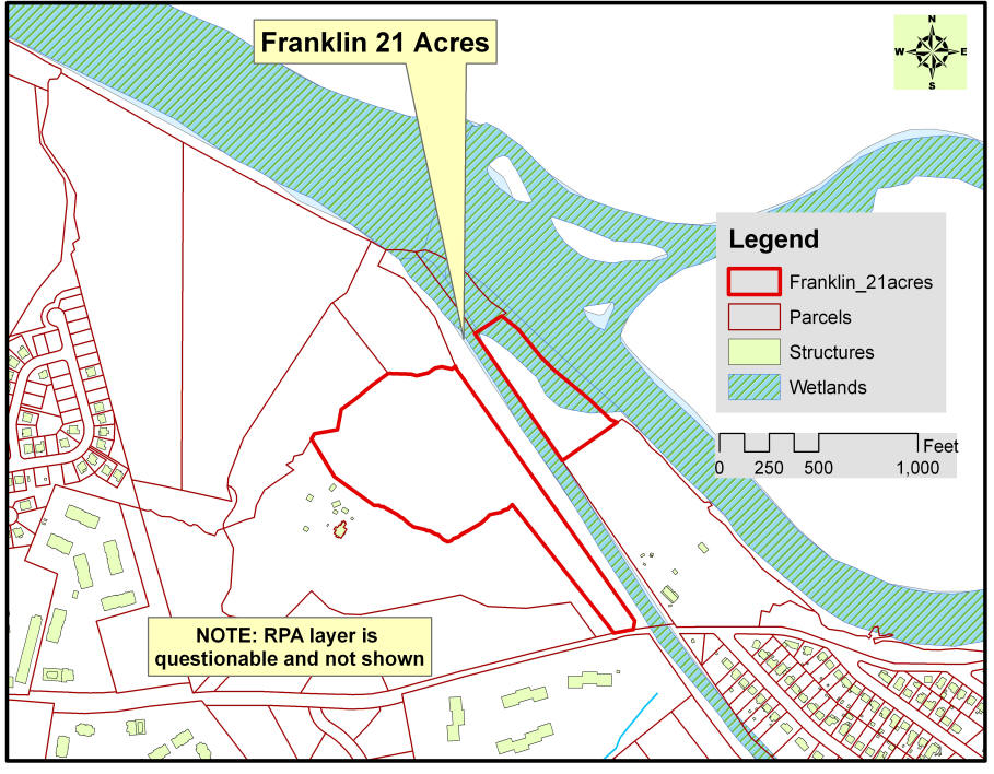 Wetlands, from City of Fredericksburg data; an approximation only.
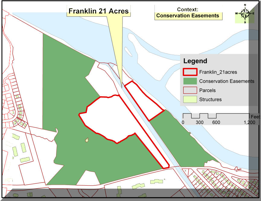
Context; Conservation Easements; Subject is bounded by conservation easements.
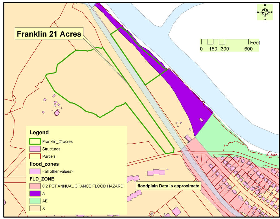 Floodplain; City of Fredericksburg data; an approximation only.
NOTE: The Owner will give consideration to selling approximately 4.2 acres on the Rappahannock River for $500,000. The parcel has about 684 feet of direct frontage on the Rappahannock River.
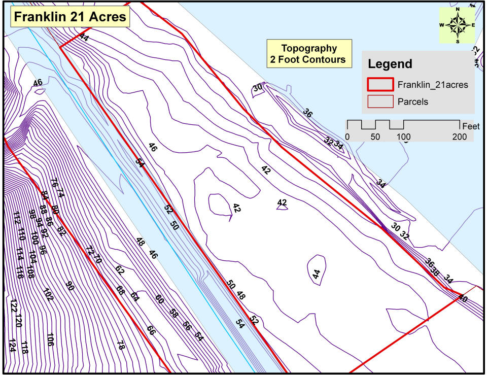
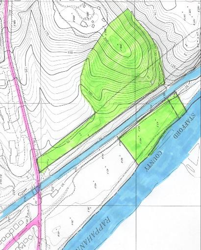
Detail, Topography, River Parcel; City of Fredericksburg, Approximation only.
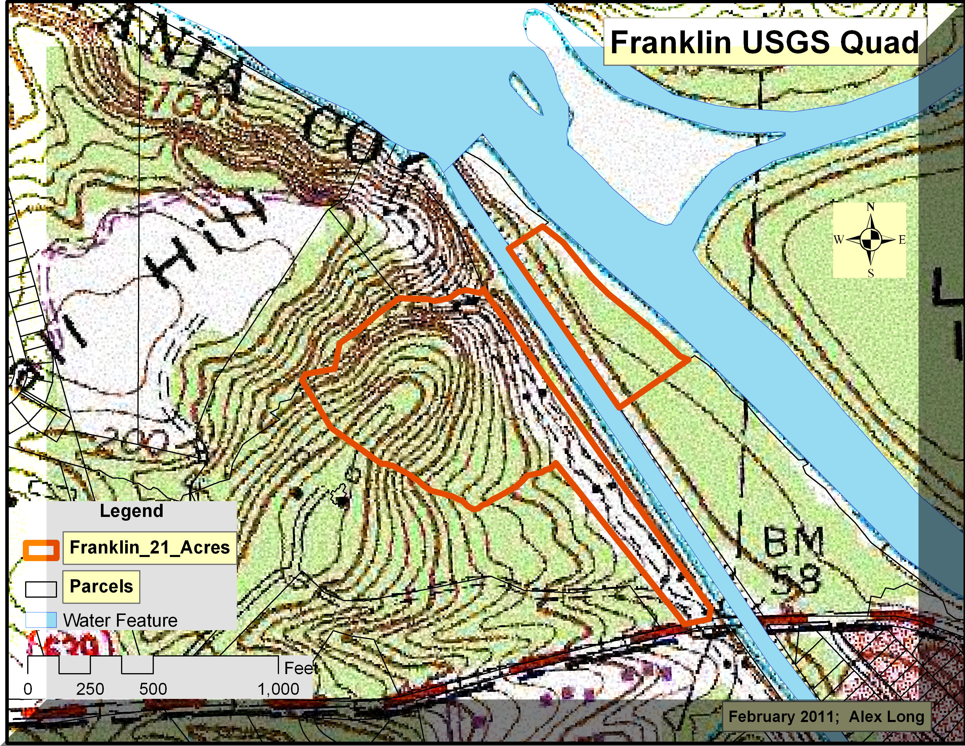 USGS Quad, an approximation of 10 foot contours
____________________________________________________________________
Hot link to City of Fredericksburg: http://www.fredericksburgva.gov/
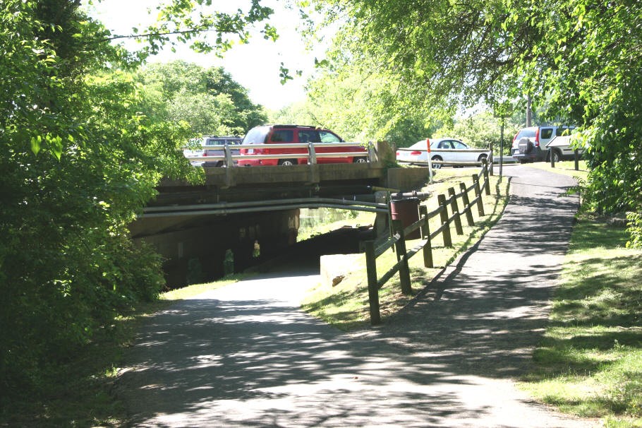
Pedestrian Access - the ultimate transportation
The "Canal Path"
|
Paved; well maintained; and parallels the Canal; | |||||||||
|
- Linkages to:
|
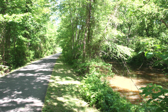 At left, photo of canal and path
![]()
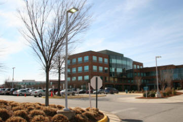
Mary Washington Hospital - a new road will directly link the hospital to this tract
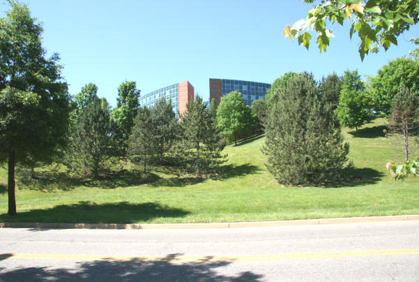
Mary Washington Hospital - performance (2011)
Net patient revenues ................................. $462,000,000
Licensed beds ............................................ 437
Average daily census.................................. 295
Admissions ............................................... 23,133
A new road will directly link this tract to Mary Washington Hospital and there is the existing paved trail.
![]()
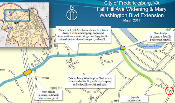
Below, the Fall Hill bridge over the Canal will be replaced and a new foot bridge, linking the Subject Property to the canal path, directly, and going under the road.
Click HERE for a PDF of the PowerPoint detailing the project.
It should be noted that in the City Comprehensive Plan, Fall Hill is to be joined to the Mary Washington Hospital loop-road, in vicinity of directly across from the Subject Property.
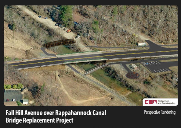
Below, Plan to widen Fall Hill Avenue and tie it into the ring road for the major hospital. The 21 acres will be at the junction of the new road
connecting the hospital and Fall Hill Avenue. The Subject property is at the canal and new bridge, to the north. This will position the Subject
property to be directly accessible to the Regional Acute Center Hospital with about 420 beds.
![]()
Context, Location, and Transportation
 An existing path connects the Hospital to the Canal Path.
The same canal path connects Fall Hill to the University of Mary Washington.
The hospital is regional, 400+ beds, an acute care offering a wide range of services from cardiac to cancer and a broad range of disciplines. An additional 300,000+ square feet of medical offices is next to the complex.
 At left, the canal path goes under U.S. Route 1, with a path leading to
the sidewalk to the right, which is next to a CVS pharmacy.
At left, the canal path goes under U.S. Route 1, with a path leading to
the sidewalk to the right, which is next to a CVS pharmacy.
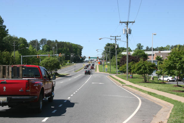
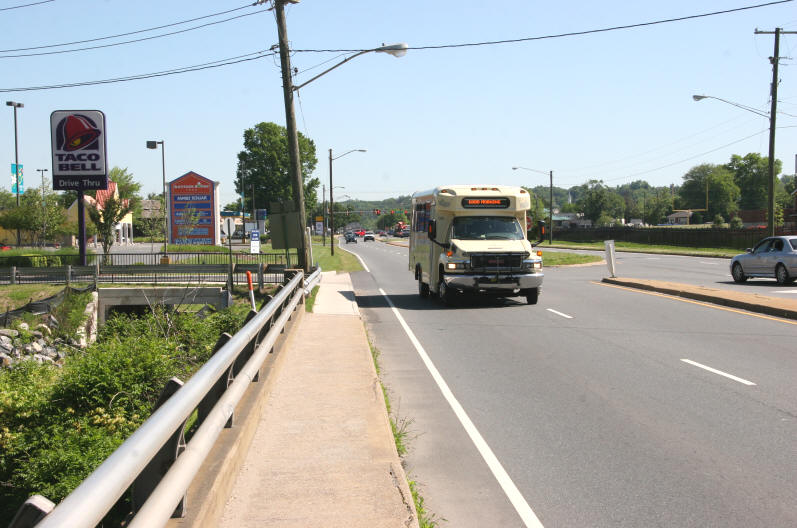 At left, view towards Rt. 1 north, a shopping center is to the left, in
the foreground to the left is the canal bridge; a FRED bus is in the
road and offers a regularly scheduled bus service in the region.
At left, view towards Rt. 1 north, a shopping center is to the left, in
the foreground to the left is the canal bridge; a FRED bus is in the
road and offers a regularly scheduled bus service in the region.
 At left, view towards Rt. 1 south, across Rt. 1 is the University of
Mary Washington. At the top of the hill is a large shopping center
the University purchased for redevelopment into a mixed use community
featuring an additional 400+ residences for students.
At left, view towards Rt. 1 south, across Rt. 1 is the University of
Mary Washington. At the top of the hill is a large shopping center
the University purchased for redevelopment into a mixed use community
featuring an additional 400+ residences for students.
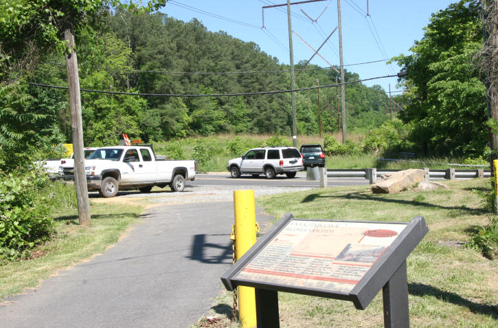 At left, view of the beginning of the Canal Path at Fall Hill Avenue.
The Subject tract is located directly across Fall Hill Avenue in the
immediate background. The Canal Path ends at Princess Anne Street,
at the Historic District for Downtown Fredericksburg.
At left, view of the beginning of the Canal Path at Fall Hill Avenue.
The Subject tract is located directly across Fall Hill Avenue in the
immediate background. The Canal Path ends at Princess Anne Street,
at the Historic District for Downtown Fredericksburg.
 A history of the Canal.
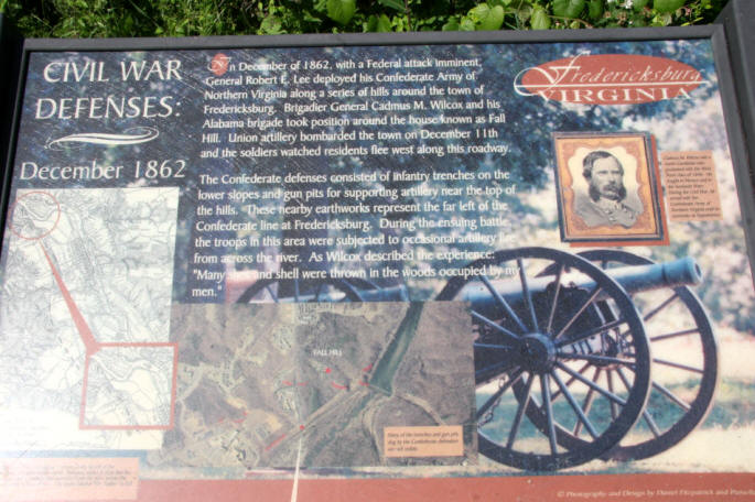 Civil War History
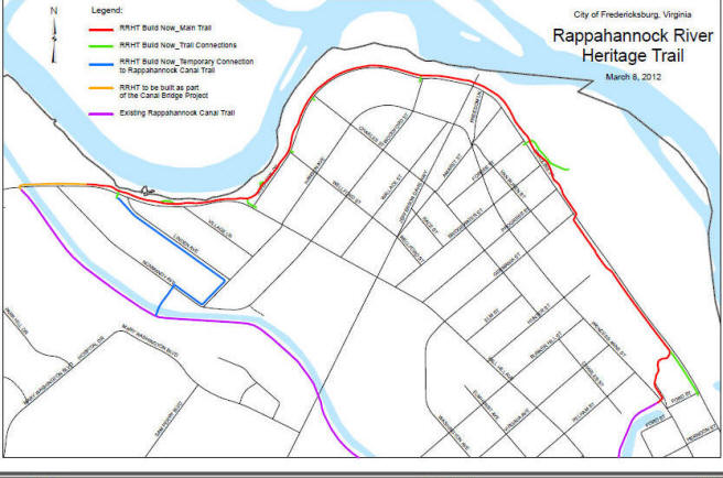
RAPPAHANNOCK RIVER HERITAGE TRAIL
Location:
Parking available in lots in Old Mill Park, along Riverside Drive, and at trailhead off Fall Hill Avenue. Hiking Time: About an hour (out and back) Difficulty: Easy, flat paved trail. Use caution crossing roadways. Length: 1.5 mile (out), 3.0 miles (out and back), 3.25 miles (Heritage and Canal Trail Loop) Features: The trail connects the two ends of the Canal Path at Fall Hill Avenue and at Princess Anne Street to complete a 3.25 mile loop. Scenic paved path along the Rappahannock River, passing by Old Mill Park and several historic buildings.
![]()
Location:
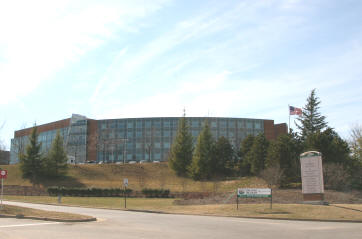
Mary Washington Hospital is a regional facility and it less than 1/2 mile from the Subject tract.
Below, Fall Hill is less than two miles from Central Park (over 2 million square feet of commercial) and the Celebrate Virginia project.

The University of Mary Washington is about a mile from Subject.
![]()
Context
The 21 acres is a part of the historic Fall Hill Estate.
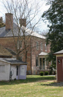
The 21 acres backs up to the historic Fall Hill mansion tract, which is under a conservation easement and remains like parkland.
Please NOTE: The Fall Hill mansion tract is NOT for sale. That property is posted "No Trespassing". Do not go on the mansion tract.
The 21 acres is shown by appointment only; please contact Alex Long for an appointment: 540.371.8700.
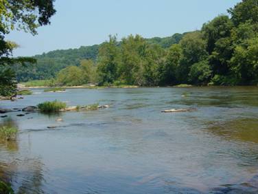
The property borders the Rappahannock River
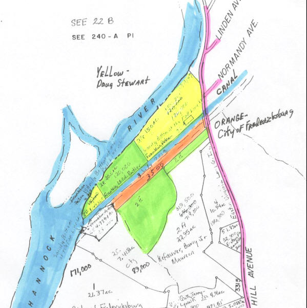
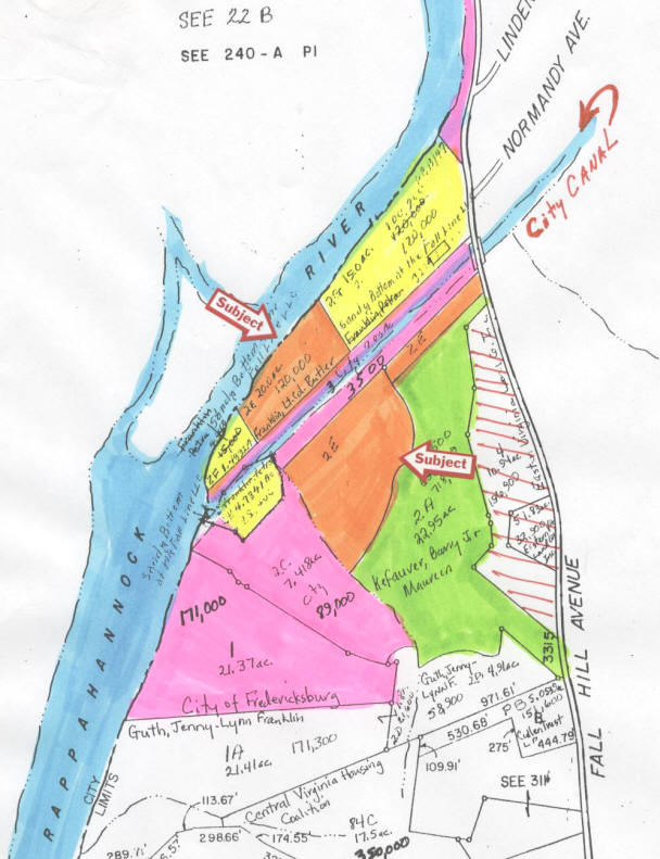 double click to enlarge, print from.
Orange - Subject Tract
Pink - City of Fredericksburg - under conservation easement; no development allowed.
Green - Mansion tract - under conservation easement; no development allowed.
Red hatched area - 13 acres, under a conservation easement, can only be four house sites.
Yellow - about 20 acres purchased for $2,100,000, cash; mostly in a flood plain.
![]()
Land Use - Conclusion:
This Tract is master planned
for "Medium Density Residential", per the 2007 City of Fredericksburg
Comprehensive Plan.
Medium Density Residential "This category permits up to eight (8) dwelling units per
acre and may include a planned mixture of single family detached and
attached units This residential density is applicable to many infill and
transition areas, to permit new development to be consistent with
existing neighborhood residential patterns." Source:
City Comp Plan, Land
Use Section, page 95:
Double click pictures to enlarge and print.
 City of Fredericksburg tax map
boundaries are approximate
boundaries are approximate
 City of Fredericksburg planemetric map;
Actually, the topography is better than the compressed copy of the topo would indicate.
boundaries are approximate.
![]()
Please go to the top of this page for the
"Plats" and "Zoning", "Development" icons.

![]()
Please NOTE: Information and comments are not guaranteed in terms of accuracy and/or scope. You are urged to independently verify and investigate any and all information and/or circumstances.
Mr. Alex Long, ALC, CCIM, AICP 540.371.8700 Licensed in Virginia
Weichert Realtors 1955 Jefferson Davis Hwy, Suite 201; Fredericksburg, VA 22401


![]()