Fall Hill
PRODUCT, MARKET:
1) Product Niche: Location near the two largest employers in the Region
- Very close to regional hospital and University of Mary Washington
2) Product Niche: Context:
- Next to City Canal
- Next to Rappahannock River
- Next to land owned by the City of Fredericksburg, under a conservation easement;
- Next to historic Fall Hill Estate, under a conservation easement;
3) Create Product to compliment context
- The "historic" market is doing better than the rest of the market; per the article:
below, from the WALL STREET JOURNAL, April 04, 2008:
Selling History by the Square Foot
Developers Mimic Historic Styles
in 'New Ruralism'; the Theme-Park Worryhttp://online.wsj.com/article_email/SB120727875841088771-lMyQjAxMDI4MDA3NDIwNzQ4Wj.html
4) Product Niche: Affordable Housing
- Not everyone working at the hospital is a doctor
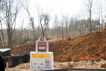
- The City recently adopted Comp Plan envisions up to 8 dwellings per acre, for the development envelope, which is about ten acres or so.
5) Product Niche: A mix of Both Affordable and more mid-upscale market housing
- Actually, true historic development patterns include a mix of housing types and styles, to that period and include "affordable housing".
- Creating a very small 'village' nestled in the woods would be a marketing advantage.
![]()
The City of Fredericksburg Comprehensive Plan - 2007
Impacts on Subject - Conclusion:
The City of Fredericksburg formally adopted a revision of its Comprehensive Plan September 25, 2007. The following are excerpts. The City Comp Plan can be viewed on line at the City of Fredericksburg web site: http://www.fredericksburgva.gov/citypubs/Comp_Plan08_FINAL_HiResPhotos.pdf
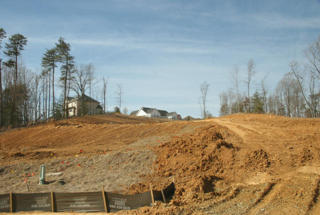
"This 20 acre parcel [Subject Tract] is cut in two [no, is about 4 acres / 17 acres] by the Rappahannock Canal. The topography on the portion west of the canal includes steep slopes [most is buildable]. The portion east of the canal is low lying wooded ground. At least half of this eastern section is within the Rappahannock River floodway. This parcel has only a single, narrow access point on Fall Hill Avenue, just west of the Rappahannock Canal. This access could be improved, though, when Mary Washington Boulevard is extended to Fall Hill Avenue and an intersection established in this vicinity. Recommended land use is medium-density residential development." Page 119
Medium Density Residential
"This category permits up to eight (8) dwelling units per acre and may include a planned mixture of single family detached and attached units This residential density is applicable to many infill and transition areas, to permit new development to be consistent with existing neighborhood residential patterns." Page 95
Also:
The City envisions Fall Hill Avenue terminating at the Canal, in front of the Subject tract and then continuing over to the main loop road of the Hospital complex, Sam Perry Boulevard.INFRASTRUCTURE
Roads
"Proposed road construction and road improvements are contained in the City’s Comprehensive Transportation (Roadways) Plan (1991) and incorporated into the regional plan of the Fredericksburg Area Metropolitan Planning Organization (FAMPO). Recently completed improvements include the extension of Sam Perry Boulevard and Mary Washington Boulevard to Cowan Boulevard. The proposed improvements to Fall Hill Avenue absolutely must be linked to an extension of Mary Washington Boulevard. The existing and anticipated traffic on Fall Hill Avenue needs to be diverted to the Route 1 Bypass rather than routed through the residential neighborhood of Normandy Village. The proposed interchange access for Celebrate Virginia does not include access to the east side of Interstate-95." Page 119.
Further, from the Comp Plan:
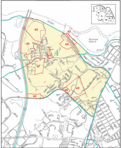
Planning Area 4 is bounded by the Rappahannock River and the Rappahannock Canal on the north, the Route 1 Bypass (Jefferson Davis Highway) on the east, Cowan Boulevard on the south, and Interstate-95 to the west. This area includes the portion of the Fall Hill Avenue corridor between I-95 and the Rappahannock Canal, and the Mary Washington Hospital campus. The Economic Development Authority’s JumpStart! report recommends specific projects on the Route 1 Bypass (Jefferson Davis Highway), Fall Hill Avenue, and Cowan Boulevard.
KEY ISSUES
Protect the Rappahannock River and scenic vistas
Protect environmentally sensitive areas such as floodplain and designated resource protection areas
Develop greenways and nature trails
Preserve the Rappahannock Canal, its adjacent Canal Path, Snowden Pond, Snowden Marsh, and other wetland resources
Protect historic sites
Expand the Mary Washington Hospital medical campus and surrounding supportive servicesand office development
Ensure Mahone Drive extended provides a well planned link between Fall Hill Avenue andCowan Boulevard. Evaluate the street name prior to extending.
EXISTING LAND USE
The planning area is characterized by multi-family residential development along Fall Hill Avenue and Cowan Boulevard, and by commercial development along the Route 1 Bypass. The greatest influence on both existing and future development in this planning area is the Mary Washington Hospital campus. Mary Washington Hospital is a full service facility that serves this entire region. It is licensed for 412 beds. The hospital is also the largest employer in the region, with over 2,800 employees. All of the preservation areas in this planning area are City-owned.
Table 27: Existing Land Use Summary - Planning Area 4
Corridor/Type Development Name Size
Fall Hill Avenue/Commercial Bragg Hill retail center small storefronts
Route 1 Bypass/Commercial Park and Shop Center 235,000 square feet
Route 1 Bypass/Commercial Fredericksburg Shopping Center 94,000 square feet
Route 1 Bypass/Commercial Snowden Office Park 48,000 square feet
Route 1 Bypass/Commercial Snowden Executive Center 65,500 square feet
Route 1 Bypass/Commercial The Park at Snowden 100,000 square feet
Route 1 Bypass/Residential Stratford Square 121 apartments
Route 1 Bypass/Commercial Park and Shop 235,000 square feet
Route 1 Bypass/Commercial Snowden Office Park 48,000 square feet
Route 1 Bypass/Commercial Snowden Executive Center 65,000 square feet
Route 1 Bypass/Commercial The Park at Snowden 100,000 square feet
Mary Washington Boulevard Mary Washington Hospital 412 beds
Fall Hill Avenue/Residential Heritage Park 200 apartments
Fall Hill Avenue/Residential Central Park Townhouses 264 townhouses
Fall Hill Avenue/Residential Crestview 180 apartments
Fall Hill Avenue/Residential Riverside Manor 189 townhomes
Fall Hill Avenue/Residential Riverview Apartments 96 apartments
Fall Hill Avenue/Residential River Walk 59 single-family homes
Cowan Boulevard/Residential Monticello Apartments 263 apartments
Cowan Boulevard/Residential Hills at Snowden 78 single-family homes
Cowan Boulevard/Residential Preserve at Smith Run 183 units (133 single-family homes;
50 townhomes)
Table 28: Preservation Areas - Planning Area 4
Name Size Description
Zig zag trenches 4.8 acres Confederate trenches dug in a unique zig-zag pattern
Uplands-deposition site 48 acres Partially cleared site with deposits from Embrey Dam removal project
Upland natural areas 28.5 Wooded natural area
RECOMMENDATIONS FOR PLANNING AREA 4
1.
Preserve the surroundings of the Fall Hill mansion.2.
Protect the historic sites and earthworks in this planning area.3.
Improve the Chesapeake Bay Preservation Area designations and other protection measures, to enhance water quality in Smith Run and in the Rappahannock River.4.
Project and maintain the natural and scenic qualities of the Rappahannock River.5.
Ensure a network of natural greenways is established and maintained for passive recreation and bicycle/foot trails.6.
Ensure an improved Fall Hill Avenue includes bicycle/foot trails, as specified in current transportation plans.7.
Protect sensitive land and provide expanded natural and open spaces through clustering of residential units and other development.8.
Establish bicycle/foot trail linkages between new developments and adjacent areas.9.
Provide for the continued development of medical offices and support services on MWH Medicorp/Mary Washington Hospital medical campus.10.
Plant trees along Cowan Boulevard, from the Route 1 Bypass to Smith Run.11.
Support redevelopment of shopping centers along the Route 1 Bypass into more productive and efficient mixed use developments, as shown in the JumpStart report.![]()
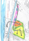
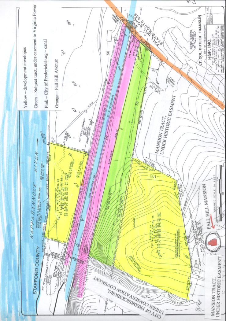
Grading and Development Concept (Concept is not guaranteed or warranted)
Click here for PDF of concept plan: (double click plan):
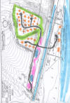
Above, a concept, per the R-1 zoning, subject to confirmation as to compliance with governmental rules and regulations. A more appealing and environmentally friendly development scenario would result from increasing the density and proffering the four acre river tract to the City of Fredericksburg.
KEY FOR THE ABOVE PLANS:
Green: buffer and or grade transition
Yellow: development envelope #1, to be graded down;
Orange: development envelope # 2, good CBR from #1 to be used as fill here.
Pink: overburden to be used to construct landscape berms along road and or wasted upon power line rights of way, per Dominion Resource guidelines.
Blue: storm water detention and or ponds
Landscape berms and ponds would be used in conjunction with plant materials to create focal points and an attractive drive into the development.
NOTE: 4.2 acres along the river would require a special use permit to develop in the floodplain. It is believed, subject to confirmation, that the chain of title supports the right to bridge across the canal to gain access to the four acre river tract.
- Either the four acre river tract is developed into ‘estate lots’;
- Or, it is used for the exclusive use of the residents of this community as a recreation resource and amenity; clearing as many trees out as possible to gain better views from the heights;
- Or, it is proffered to the City of Fredericksburg as a park, with access for this community as well, in exchange for a higher density to create a more attractive and environmental friendly development.
Development - Residential:
(please see other development scenarios, below)
NOTE:
All information is conjectural and subject to independent verification and analysis.
Residential Development:
1) By right, at R-1; see icon, "Zoning"
2) Perhaps proffer the 4+ acres on the Rappahannock River to the City for a park, retaining the rights for the residents of the development to use the park, and perhaps gain an R-4 zoning.
Issues up front:
| The power line easement takes up about 4 acres of Subject; | |
| Topography is an issue; | |
| About 4 acres is divided from the main body of Subject by the City of Fredericksburg property and canal. | |
| There are some Civil War trenches near the top of the hill; however, there was no fighting at that location. |
Double click, above to read and or print
The Case for Development:
| Subject has a superior location, only minutes from the Regional hospital; University, downtown, etc. | |||||||
| Subject is in an Estate neighborhood, contiguous to property under historic preservation easements; | |||||||
The
main development envelope is about 12 acres (21 acres less
the 5 acres in the power line R/W and less the 4+ acres along the
river).
| |||||||
| Basically, the trees would be removed from the approximately 12+ acre development envelop AND the 4 acres along the river (as much tree removal as the Chesapeake Bay Act will allow) and thus create a better water view from the main development envelop; then, after removing the over burden and stacking it as a berm and or possibly putting it under the power line R/W, the next task would be to pan the top of the hill down into the lower section, creating a tiered development envelop. |
Below, the Estates of Idelwild; the topography was as formidable, if not worse than the Subject tract.
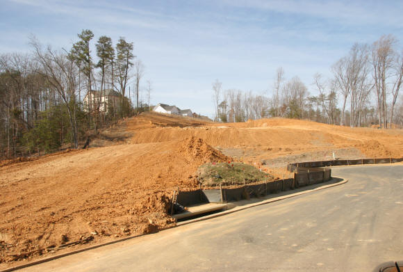
Above, this house site ($600,000+ with house) is a narrow band of land backing up to a steep ravine.
Family Compound:
| Subject is zoned R1, residential, allowing for multiple lots | |
| Subject would make a great "compound" development of a few large estate type houses, one or two at the top of the hill and then several houses at the lower tier. |
Development - Institutional
| Subject might make for a great site for a religious organization or private school, e | |
| The topography could be molded to create a tiered effect for the development envelopes. |
| NOTE: Fall Hill Avenue road improvement project will tie Fall Hill Avenue in front of Subject directly into the Hospital ring road, for direct connections to the hospital. | |
|
![]()
Please NOTE: Information and comments are not guaranteed in terms of accuracy and/or scope. You are urged to independently verify and investigate any and all information and/or circumstances.
Mr. Alex Long, ALC, CCIM, AICP 540.371.8700 Licensed in Virginia
Weichert Realtors 1955 Jefferson Davis Hwy, Suite 201; Fredericksburg, VA 22401


![]()