
Above, looking from Port Royal at the property across the river; the rainbow seems to come from the property.
Is this your pot of gold at the end of the rainbow?
Outstanding Opportunity
Either:
5.8 acres on with about 430 feet on the Rappahannock River; $220,000;
Or
12.8 acres with about 920 feet of frontage on the Rappahannock River; including two estate lots; a house each; $400,000
![]()

Above, photo of a fawn taken on the property; the fawn ran away after the photo was taken.
![]()
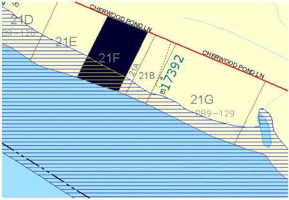
21F .......................... 5.8 acres; 430 feet on river
21E .......................... 7.0 acres; 490 feet on river
Total......................... 12.8 acres; 920 feet on river
Below, outlined in Orange, are two lots:
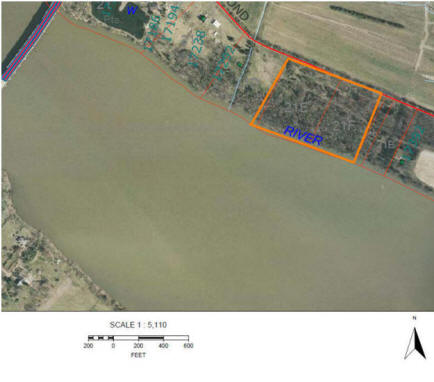
![]()
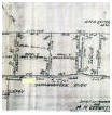
Below, double click to view and/or print plat of survey.
The Property is lot "E"; 430 feet of frontage on the Rappahannock River.
5.8 acres; double click to view or print:
![]()
The combined estate lots have more river frontage than farms of 50 or even 100 acres. The 5.8 acres has twice as much, if not more more river frontage than many subdivision lots on the river.
Below, is the 5.8 acres.
![]()
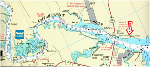
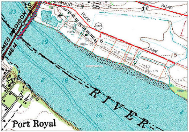
Below, a river chart of the area showing the property relative to the Town of Port Royal and the depth of the water.
The water near the shore is about a foot to two feet at low tide, generally, the channel depth varies from 15 to 60 feet in depth. Tide is about two feet vertical.
![]()
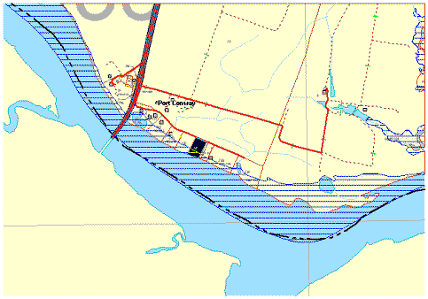
Above, the tax map with an overlay of the 100 year floodplain. Yes, it has flood plain because the land gently slopes to the water. There are lots with very little flood plain because they are very steep and owners spend a lot of money building structures to get down to the water. It is a trade-off between no flood plain and steep banks or some flood plain and immediate access to the water.
Questions about Zoning or Land Use or Chesapeake Bay Act?

Community Development Office
"Our Mission is to provide Quality Customer Service"
The Department of Community Development is located in the Revercomb Administration Building, 10459 Courthouse Drive, Suite 104
Our office hours are 8 AM - 5 PM Monday-Friday
540-775-7111 (phone) 540-775-3139 (fax)
________________________________________________________
Web site for King George County: http://www.king-george.va.us/
________________________________________________________![]()
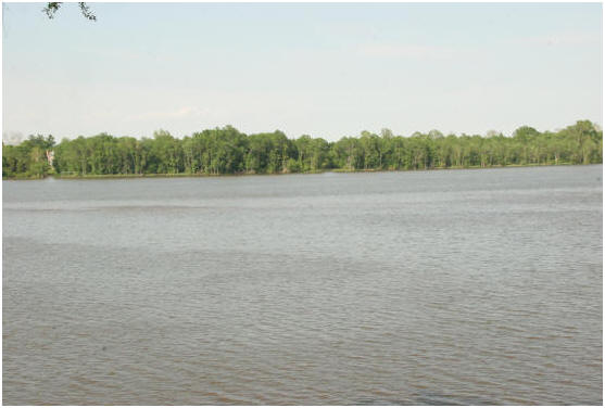
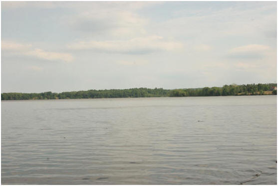
views of the Rappahannock River
![]()
Below, U.S.G.S. quad map showing elevations.
![]()
· Port Royal's 17th century pirate is immortalized in the name Peumansend Creek. A French pirate, a Monsieur Peuman, was the scourge of the settlers. Eventually they chased him up the creek and killed him. Thus the name "Peuman's End", a name which appeared on deeds as early as 1670.
![]()
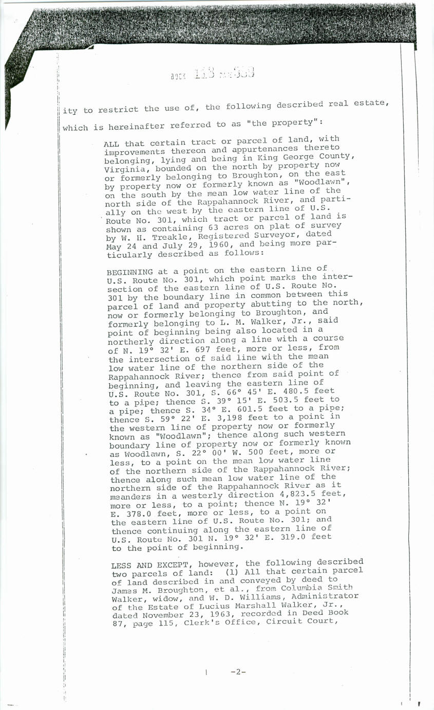
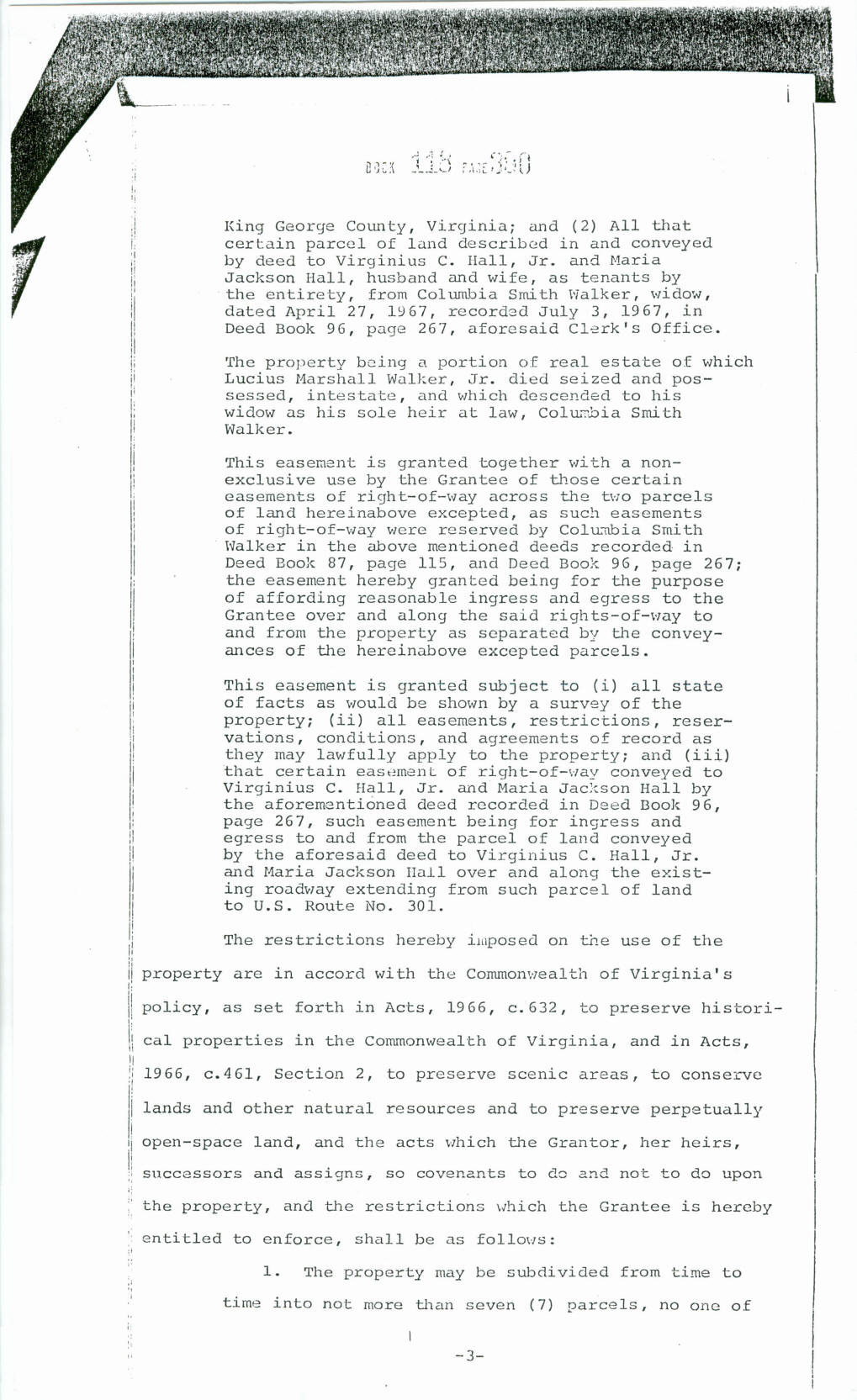
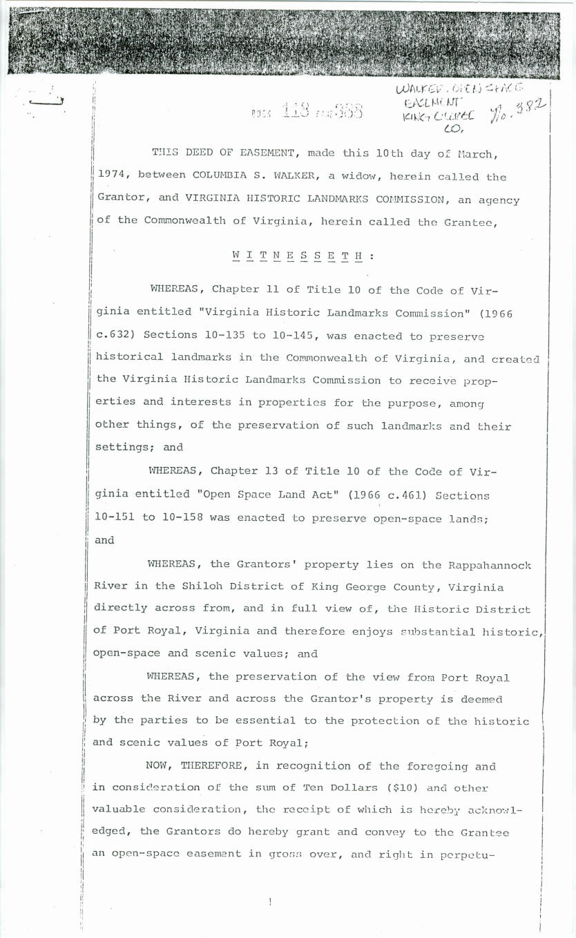
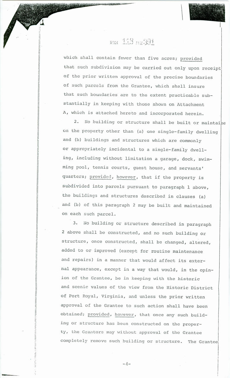
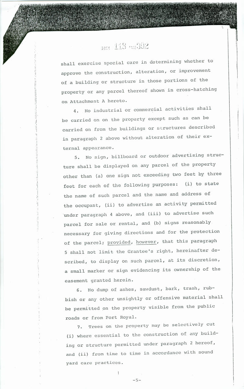
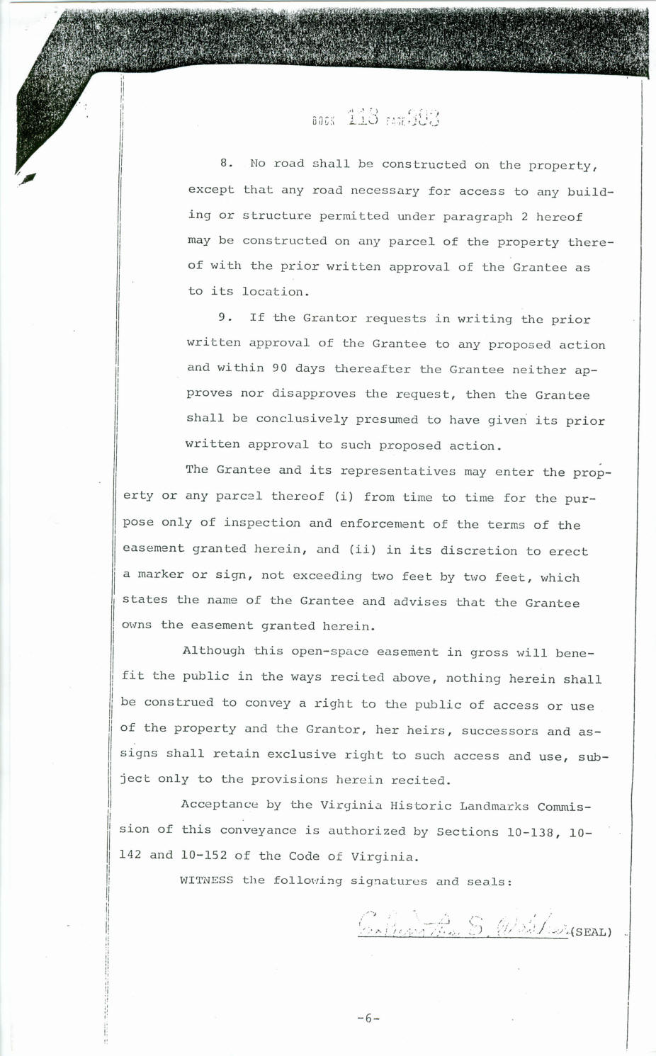
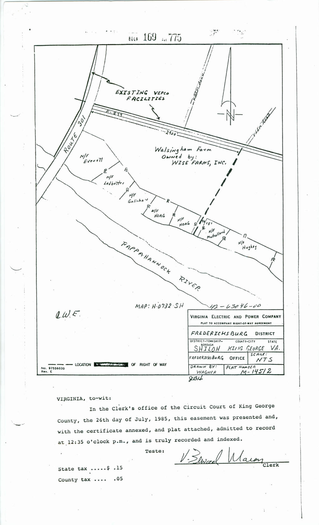
The property is subject to a conservation easement made to the Virginia Department of Historic Resources, as are the adjoining parcels.
Below, are the pages from the Conservation easement which applies to this Property and the other properties nearby. Double-click to enlarge and/or print.
Please NOTE: the easement allows each lot to have a main house and guest house, pool, dock, seperate garage and a barn; subject to King George County regulations.


_______________________________________________
Web site for Town of Port Royal historic http://www.co.caroline.va.us/portroyal.html
_______________________________________________
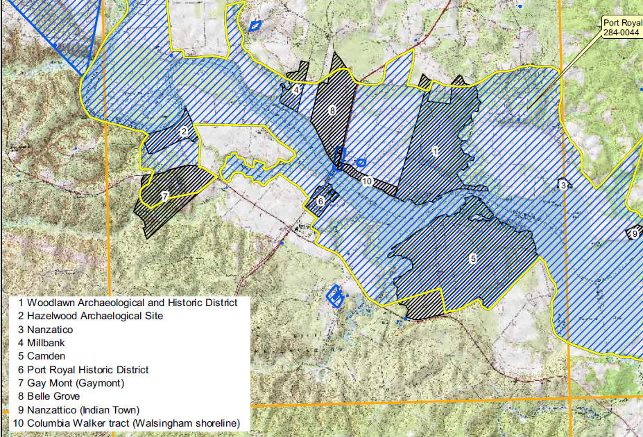
Below, double click for map of the Greater Rural Port Royal Historic District
Click HERE for narrative explaining the Greater Rural Port Royal Historic District, which has been submitted but not yet fully adopted.
![]()
_________________________________________________________________
Fort A.P. Hill is a DOD training facility several miles away. It is quiet now. However, there are periods of noise when certain types of training take place.
Any questions can be directed to Fort AP Hill; the web site link is below:
http://www.aphill.army.mil/sites/local/
![]()
Please NOTE: Information and comments are not guaranteed in terms of accuracy and/or scope. You are urged to independently verify and investigate any and all information and/or circumstances.
Mr. Alex Long, ALC, CCIM, AICP 540.371.8700 Licensed in Virginia
Weichert Realtors 1955 Jefferson Davis Hwy, Suite 201; Fredericksburg, VA 22401


![]()